2.7.820 Districts.
A. Applicability. The standards provided for the Murphy Crossing Refinement Plan area by this section shall supersede the otherwise applicable standards of this Development Code, except where those other standards expressly state they are to supersede the standards of this section.
B. District Location. The locations of the zoning overlay districts are depicted on the adopted Murphy Crossing Master Development Plan map and as described below.
|
Zoning Overlay District (Zone) |
Location and Characteristics |
|---|---|
|
Park/Open Space (PF) |
This area is centrally located within the Refinement Plan area and is intended for park development by the Bend Metro Park and Recreation District as a neighborhood park. |
|
Park Open Space (RL) |
These open space areas serve as a special buffer between more intense development and/or new roadway alignments. The open space area can provide passive pedestrian connections linking existing residential development with the new Murphy Crossing commercial center. |
|
Single-Unit Residential (RS) |
Located along the western boundary of the refinement plan area and predominantly north of Romaine Village Way, this area provides a transition between the existing Low Density Residential (RL) housing and the new Murphy Crossing development. The minimum lot size within the RS Zone will be 6,000 sq. ft. with a minimum lot depth of 100 feet when lots abut existing RL development. Homes may be clustered or attached as zero lot line to provide maximum preservation of existing trees. |
|
Multi-Unit Residential (RM) |
The RM overlay located within the central plan area provides a transition between the new standard density single-unit homes and the more intense commercial development along the easterly portion of the refinement plan area. RM development is also located at the north and south ends of the plan area along the Parkway. The density range is 7.3 to 21.7 units per gross acre. |
|
Mixed-Use (ME) |
The Mixed-Use District is applied to areas of Murphy Crossing adjacent to primary commercial streets, to provide opportunities for a variety of smaller-scale, pedestrian-oriented commercial uses located in ground-floor street frontages, with residential uses and offices above. Residential units may be located on the ground floor when adjacent to other multi-unit dwellings. The residential density for the residential component of mixed-use projects shall not exceed 21.7 units per gross acre. |
|
General Commercial (CG) |
Located primarily between the Bend Parkway and the north/south frontage road, the General Commercial District provides for a mix of commercial uses with large site requirements and smaller-scale service commercial uses that can provide a pedestrian-oriented street frontage. |
C. Permitted Land Uses. Unless otherwise specified in the table below, the land uses listed within the applicable zoning districts within this Development Code must be permitted, subject to the provisions of this code.
|
Land Use |
RS |
RM |
ME |
CG |
|
|---|---|---|---|---|---|
|
Residential |
|||||
|
All residential uses permitted or conditionally allowed in the underlying zoning district |
P/C |
P/C |
P/C |
P/C |
|
|
Commercial/Mixed-Use |
|||||
|
All Commercial/Mixed-Use Buildings |
|||||
|
• Building footprint less than 10,000 sq. ft. |
N |
N |
P |
P |
|
|
• Building footprint 10,000 – 20,000 sq. ft. w/ max. building size of 30,000 gross sq. ft. |
N |
N |
C |
P |
|
|
• Building footprint 20,000 – 50,000 sq. ft. w/ max. building size of 60,000 sq. ft. |
N |
N |
N |
P |
|
|
• Building footprint greater than 50,000 sq. ft. w/ max. building size of 100,000 sq. ft. (location restricted to the north 400 ft. of the CG Zone) |
N |
N |
N |
P |
|
|
Recreation Facilities |
N |
N |
C |
C |
|
|
Miscellaneous Uses |
|||||
|
Shelters, see BDC 3.6.600 |
P |
P |
P |
P |
|
D. Special Development Standards. In addition to the development standards outlined in the City’s Development Code, the following standards apply:
|
Standard |
RS Single-Unit |
RM Multi-Unit |
ME Mixed-Use |
CG General Commercial |
||
|---|---|---|---|---|---|---|
|
Density |
4 – 7.3 units/gross acre |
7.3 – 21.7 units/gross acre |
NA |
|||
|
Setbacks: |
||||||
|
• Front |
Min. of 6 ft. for home, 20 ft. for garage |
Min. of 6 ft. for home, 20 ft. for garage. Building entrances shall be oriented to the street front. Max. setback shall be 10 ft. |
Min. of 5 ft. Max. setback shall be 10 ft. Except forecourt frontage may be 20 ft. |
Min. of 5 ft. Max. setback shall be 10 ft. Except forecourt frontage may be 20 ft. |
||
|
• Side |
Min. of 5 ft. for 1 side and the sum of 2 side yards shall be 12 ft. |
Min. of 5 ft. |
No minimum required, except when abutting an “R” zone see BDC 2.2.400(A)(6) |
No minimum required, except when abutting an “R” zone see BDC 2.2.400(A)(6) |
||
|
• Rear |
Min. 15 ft. |
Min. 10 ft. |
No minimum required, except when abutting an “R” zone see BDC 2.2.400(A)(6) |
No minimum required, except when abutting an “R” zone see BDC 2.2.400(A)(6) |
||
|
Lot coverage |
35% |
40% |
50% |
NA |
||
|
Building height |
35 ft. |
30 ft./2 stories for buildings fronting on Murphy Road and the local north/south street bordering the park. 40 ft./3-story buildings are permitted elsewhere. *See Exceptions below |
45 ft./3 stories |
|||
|
Lot access |
Where new RS lots abut existing RL development, access shall be from the street. All other lots shall access from an alley. |
All vehicular access shall be from an alley/private drive or internal parking lot. |
||||
|
Parking standards |
See BDC Chapter 3.3, Vehicle Parking, Loading and Bicycle Parking. |
|||||
|
Frontage types |
Not regulated |
• Front Yard and Porch • Stoop |
• Stoop • Forecourt • Storefront |
• Forecourt • Storefront • Gallery |
||
|
Min. building frontage |
Not regulated |
50% |
80% |
65% |
||
|
Special landscape setback |
1. |
Development along the east side of the north/south local street bordering the park between Murphy Road and the southern frontage road alignment shall provide an additional 10-foot landscaped pedestrian easement. The easement shall be combined with the street right-of-way to provide a pleasant pedestrian trail system the length of the Murphy Crossing project area that will easily connect to existing and planned trails, parks and open space. The pedestrian trail replaces the required sidewalk along that street frontage. |
||||
|
2. |
Development along both sides of the frontage road between Murphy Road and the Parkway off-ramp/roundabout shall provide an additional 4 ft. of sidewalk adjacent to the public sidewalk. |
|||||
|
Architectural design |
||||||
*Single-unit homes on adjoining lots shall share a common wall where it can be shown that tree preservation can be maximized.
1. Buffering Standards. All loading and delivery areas shall be oriented away from residential neighborhoods and screened from view using a combination of vegetation, fences and walls.
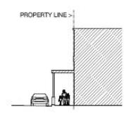
2. Building Height Exceptions. Buildings in the RM Zone that front on Murphy Road and the local north/south street which borders the park may be 40 feet tall or three stories when the portions of the building over 30 feet in height step back a minimum of 30 feet from the front property line.
E. Frontage Types. The street facing facade of each proposed building shall be designed as one of the building frontage types allowed by the applicable zoning district as indicated in Table 2.7.820.D. Building frontage placement on the lots shall comply with the setback requirements of the applicable zone. For the purpose of this code, building frontage means the lineal length of facade facing the street.
|
1. |
Front Yard and Porch. The building facade is set back from the property line (frontage line) as required by the applicable zone, with a front porch providing a covered entry. A fence or wall not more than 36 inches high may define the private space of the yard. Porches shall be at least six feet deep and 12 feet wide and may be elevated no more than 36 inches above the surrounding grade. |
|
|
2. |
Stoop. The building facade is placed close to the property line with the ground floor either elevated a minimum of 24 (but no more than 36) inches above the sidewalk, or the facade is up to 10 feet from the back of the sidewalk, with an optional low fence not more than 36 inches at the back of the sidewalk. This type is suitable for ground-floor residential uses with minimal setbacks. |
|
|
3. |
Forecourt. Most of the building facade is at the property line with a portion of the facade set back. The resulting forecourt is suitable for gardens, restaurant seating, or an entry plaza. This type should be used sparingly and in conjunction with other frontage types, as an extensive setback deters pedestrians. Trees within forecourts should be placed to have their canopies overhang the street’s sidewalk. A low wall or fence no greater than 36 inches high may also be placed at the property line. |
|
|
4. |
Storefront. The building facade is placed at or close to the property line with the building entrance (which may be recessed) at sidewalk grade. This frontage type is intended for retail uses and is commonly equipped with an awning. An awning extending over the public sidewalk requires City approval. Transparent windows shall occupy at least 65 percent of the first-floor wall area of each storefront. |
|
|
5. |
Gallery. A gallery is a storefront with an attached colonnade that projects over a sidewalk. This frontage type is intended for retail use, but only when the sidewalk is fully covered by the arcade so that a pedestrian must walk under it. The City must approve any portion of the structure that extends into the public right-of-way. |
|
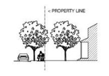
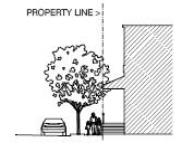
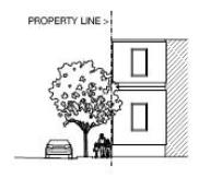
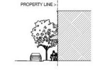
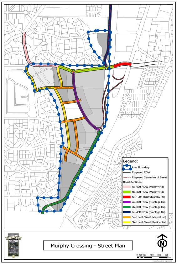
F. Street Design Types. The roads within Murphy Crossing will have different designs based on their location and function. The diagram is the key to the different street types. Each street type design will be illustrated in a cross-section and described below.
The designated streets within Murphy Crossing are required street elements. The street alignments depicted are generally located to provide reasonable lot sizes and connectivity within the refinement plan area. During tentative plan development or site plan review, the street alignments of proposed streets shall be shown in their general location. The street alignments may move up to 30 feet in one direction without requiring a refinement plan amendment.
[Ord. NS-2487, 2023; Ord. NS-2443, 2022; Ord. NS-2423, 2021; Ord. NS-2303, 2018; Ord. NS-2031, 2006; Ord. NS-2016, 2006]