Environmental
The City recognizes the need to steward the environment when constructing and maintaining transportation infrastructure. The City has many policies embedded throughout this Chapter intended to reduce greenhouse gases and vehicle miles traveled (VMT) by encouraging bicycling, walking, transit, and electric or other alternately fueled vehicles, as well as using appropriate new technologies to efficiently manage the system. The following policies were identified as gaps in the City’s environmental policies.
7-62 The City will consider the environmental impacts of the overall transportation system and act to mitigate negative effects and enhance positive features.
7-63 The City understands the importance of managing stormwater runoff from transportation infrastructure and will design and operate transportation infrastructure to keep stormwater properly collected, treated, and out of water supplies.
Figure 7-1. Functional Classification Map
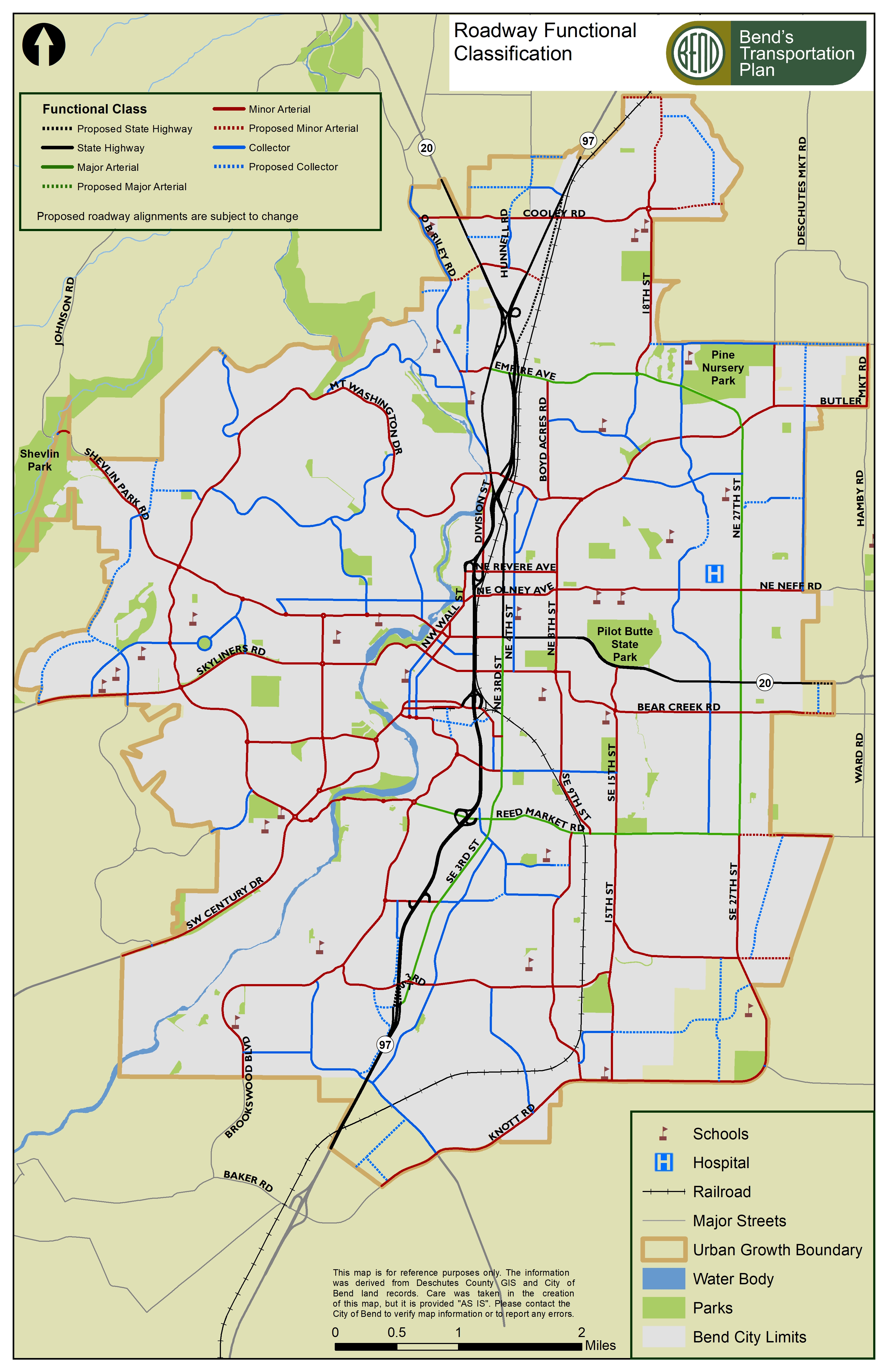
Note: Any Bend TSP map that illustrates a dashed line for a proposed transportation facility may be updated administratively by staff upon the construction/completion of that facility. Updating of any affected maps shall convert any “dashed” lines into “solid” lines that follow as-built alignments, as much as practical, and shall not constitute a land use decision.
Figure 7-2. Key Walking and Bicycling Routes and Low Stress Network Map
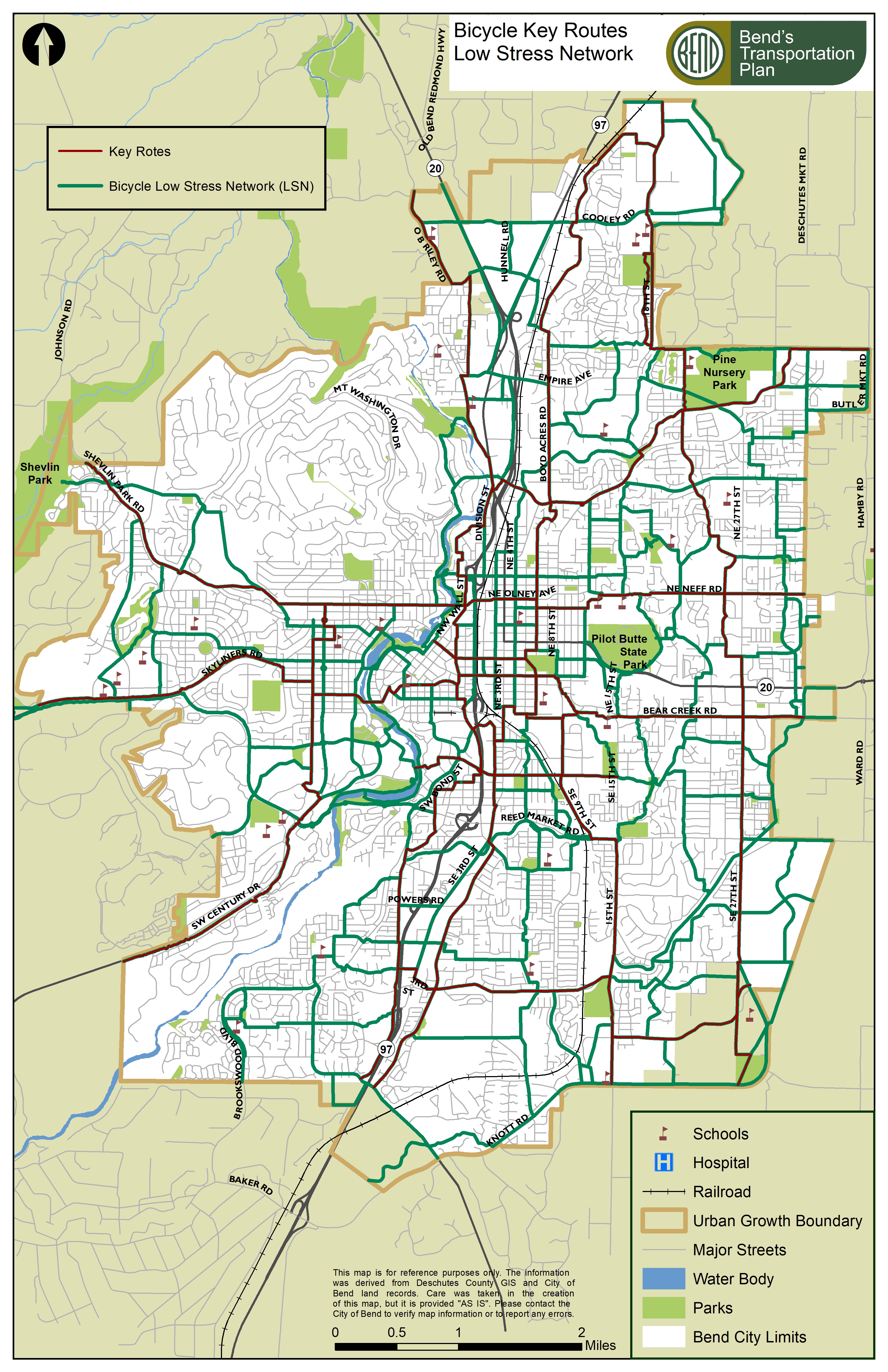
Note: Any TSP and CP map that illustrates a proposed low stress route may be updated administratively by staff upon the adoption of a master plan and/or construction/completion of that route that follow the adopted alignments and/or as-built alignments, as much as practical, and shall not constitute a land use decision.
Figure 7-3. Mobility Hub and Primary Transit Corridor Map
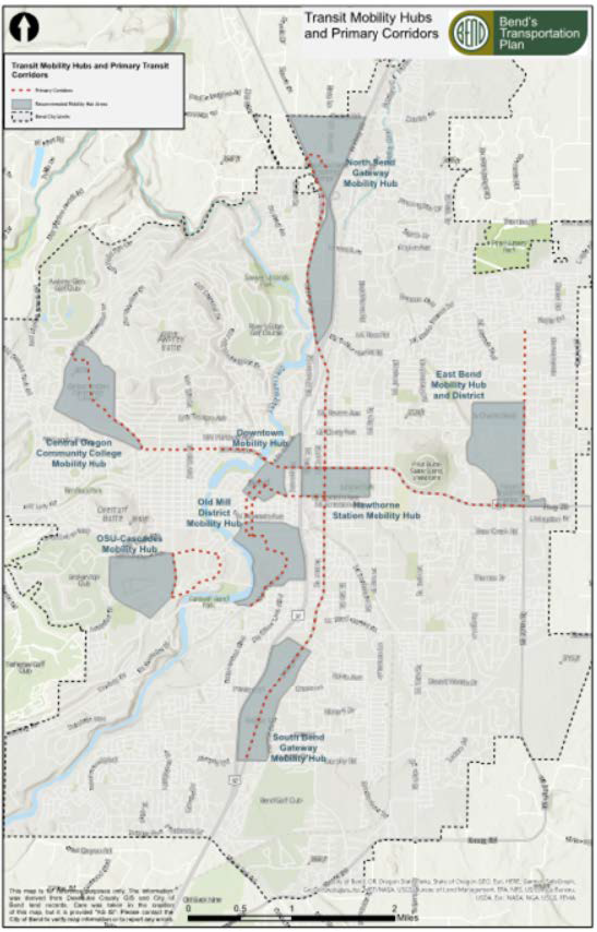
Note: The specific location of mobility hubs is preliminary and are intended to be located within each of the eight recommended mobility hub areas identified through the Bend Mobility Hub Feasibility Study. The City and CET will coordinate on specific locations for these facilities as they are identified and developed. The map may be updated administratively by staff as mobility hubs are built and shall not constitute a land use decision.